What is an underserved community?
Its all about access. Underserved communities are communities who lack access to one or more necessary resources. The communities tend to have significant minority communities (though that is not a defining feature), and lack proper access to food, shelter, transportation, etc.
Community Need Center
|
This project required my class and I to research underserved communities in Dallas. To do this, we began by looking at maps that exemplify disparities in the entirety Dallas, so that we can pinpoint an area that is particularly in need.
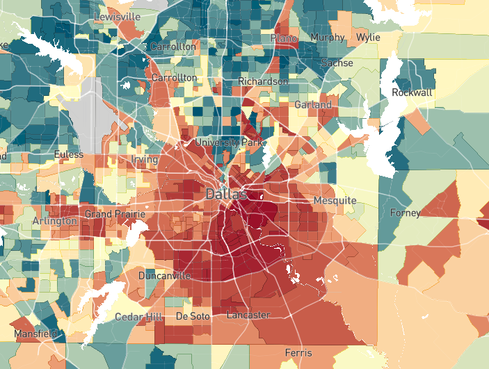
The map shown on the right displays the poverty rates in Dallas County. The darker red color represents communities in Dallas that have a higher poverty rate. What my and my classmates noticed as the concentration of poverty in two places. 1. Below I-30, and 2. In the Southeastern portion of the City of Dallas. 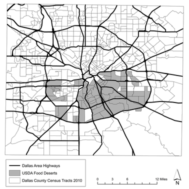
|
The picture on the left shows where food deserts are in the Dallas area. We found a similar concentration of food deserts below I-30. According to the Dallas Observer, "Food deserts are places where people don’t have access to healthy food options within a 5-mile radius of their homes. Grocers often say high crime statistics, low income and a lack of other stores keep them out of such areas."
Because of our findings, me and my classmates decided to choose communities in the southeastern area. We each chose a neighborhood we felt was particularly effected, and researched them thoroughly.
|
We gathered a lot of information into this Padlet. We decided to share our resources while trying to discover just what an underserved community looks like.
My personal research was over the neighborhood of Bonton (or Bon Ton). This neighborhood was originally a settlement for middle class black families, and was the target of racial based attacks, burning of houses, etc. In the 90s, community organizations and activism caused the neighborhood to grow. Racialized city planning has caused inequalities still present today.
The statistics I found are concerning. With a poverty rate of 43%, and a graduation rate sitting at 58%, I found myself motivated to solve these two problems. I became attached to this neighborhood, so I decided to build my project around it and its inhabitants.
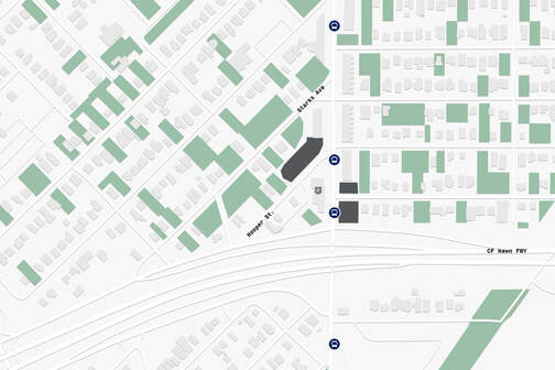
Shown in the slideshow, I established 3 plots of land as possible sites for my project. I ultimately decided on site 3, as its closeness to Bexar Street (a historically and physically important street for the neighborhood), allowed for a more central location for the whole neighborhood. It is also located right next to a bus stop, so the transportation access is good. After researching further, I discovered that the "neighborhood" I was examining was actually two neighborhoods. The site I selected was in a neighborhood called Ideal.
The statistics I found are concerning. With a poverty rate of 43%, and a graduation rate sitting at 58%, I found myself motivated to solve these two problems. I became attached to this neighborhood, so I decided to build my project around it and its inhabitants.
Shown in the slideshow, I established 3 plots of land as possible sites for my project. I ultimately decided on site 3, as its closeness to Bexar Street (a historically and physically important street for the neighborhood), allowed for a more central location for the whole neighborhood. It is also located right next to a bus stop, so the transportation access is good. After researching further, I discovered that the "neighborhood" I was examining was actually two neighborhoods. The site I selected was in a neighborhood called Ideal.
|
|
| ||
|
This documentary covers the history of the two neighborhoods.
|
This PDF leads you to the a project that helped me greatly while researching the neighborhoods.
|
Site Analysis
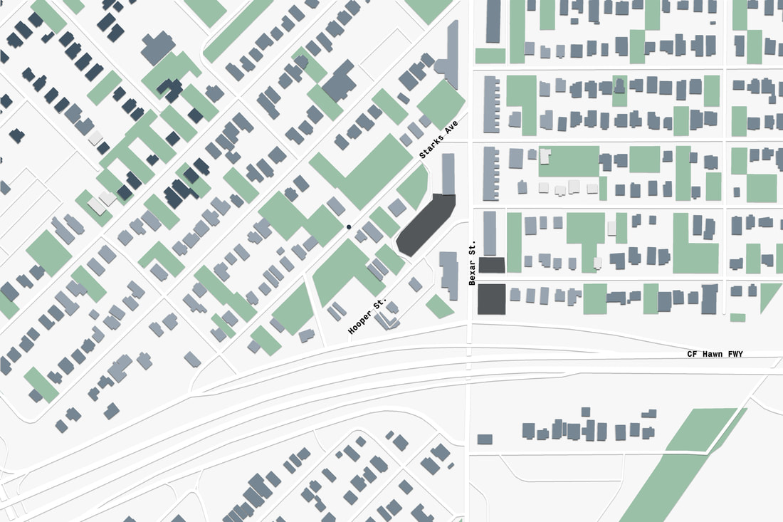
Now that my site was selected, I had to look at the physical environment as opposed to just the social environment. I made multiple site analyses to provide information on different factors of the neighborhood.
|
|
|
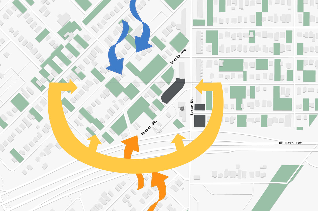
This is the transportation analysis. Bus Stops are shown and he darker grey lots represent my planned site.
|
This is the Environmental site analysis. The sun comes from the south, and there are winds from the north during winter, and wind from the south in summer.
|
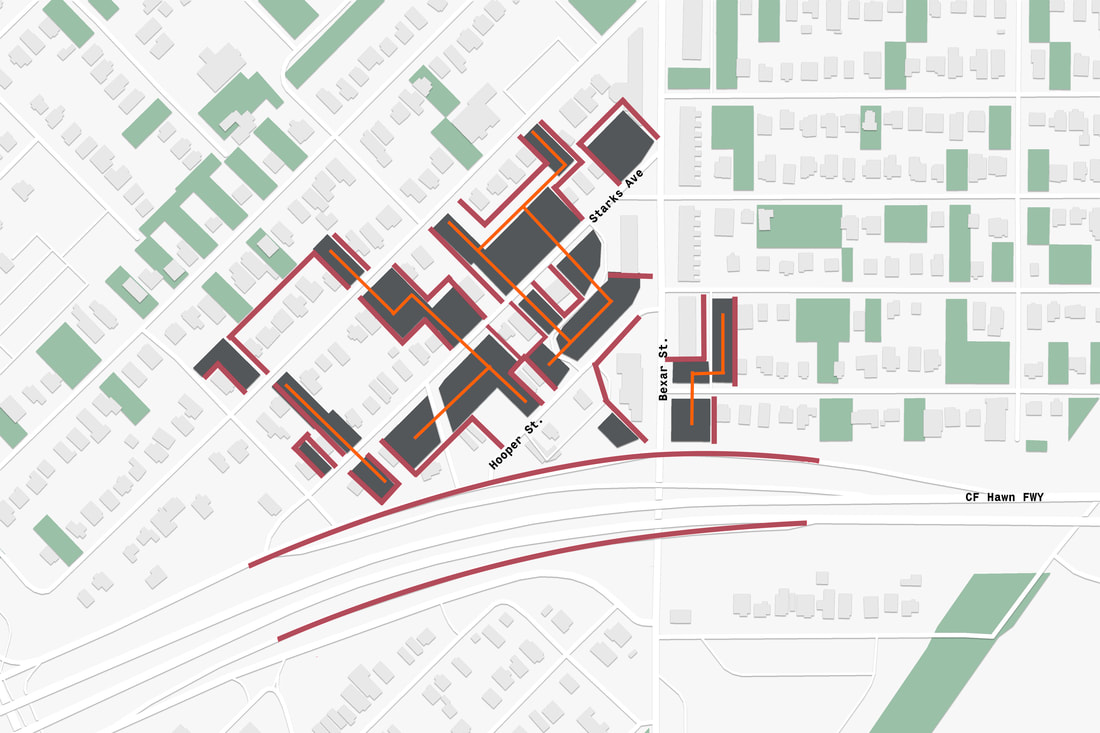
The analysis shows boundaries and continuities. This helped me decide were to put my site.
|
Walking distance to point near site. Lighter Blue is a 5 minute walk, medium is 10, and dark is 15.
|
Masterplan
I had a rough idea of what I wanted to build, so I made a masterplan that provides some key basic information about the buildings.
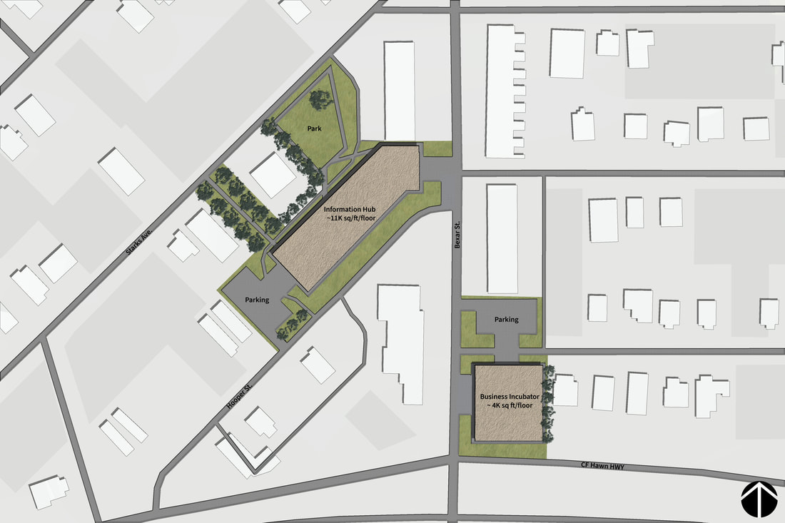
The site selection allowed me to start realizing my project. I wanted to improve the education rates, I thought a good way to do this would be to build a library that serves the entire community. Additionally, I thought that incorporating some type of job training site in the building would be beneficial to improve employment rates in the community. To tie in with the job training, I though a business incubator on the other side of the road could create this bridge across Bexar.
|
|
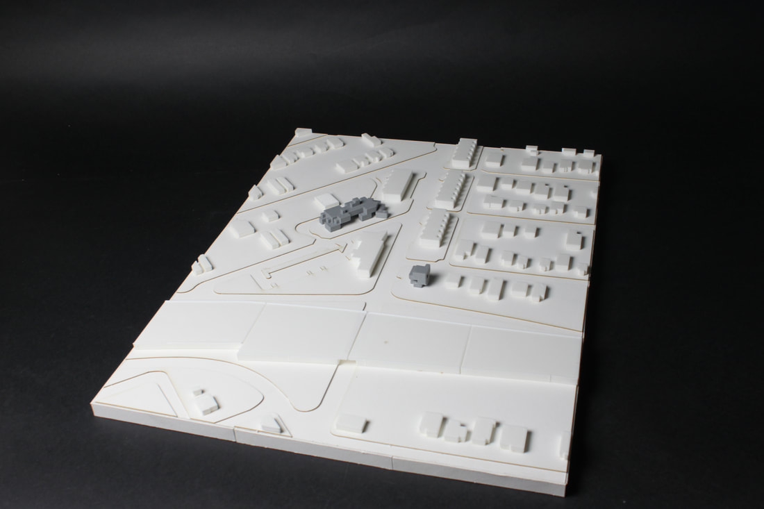
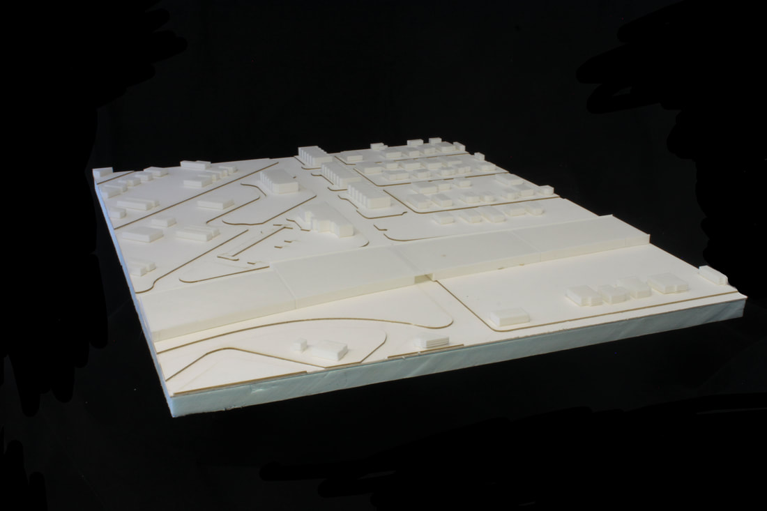
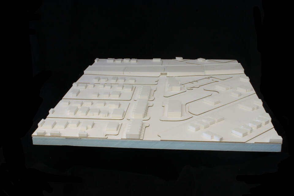
These are site models of the site and surrounding structures.
Concepts
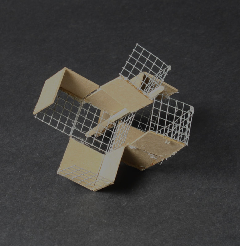
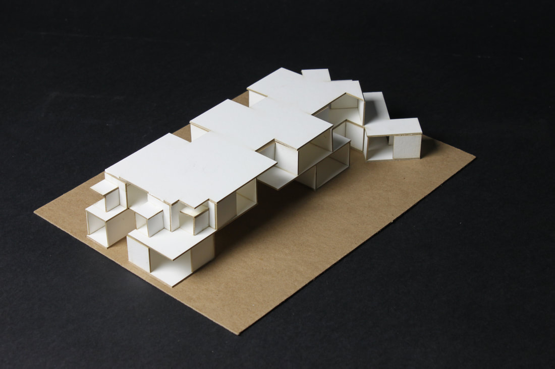
3D Model that inspired concepts.
|
Library Concept Drawing
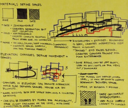
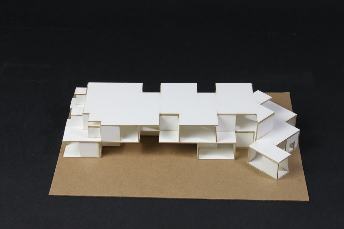
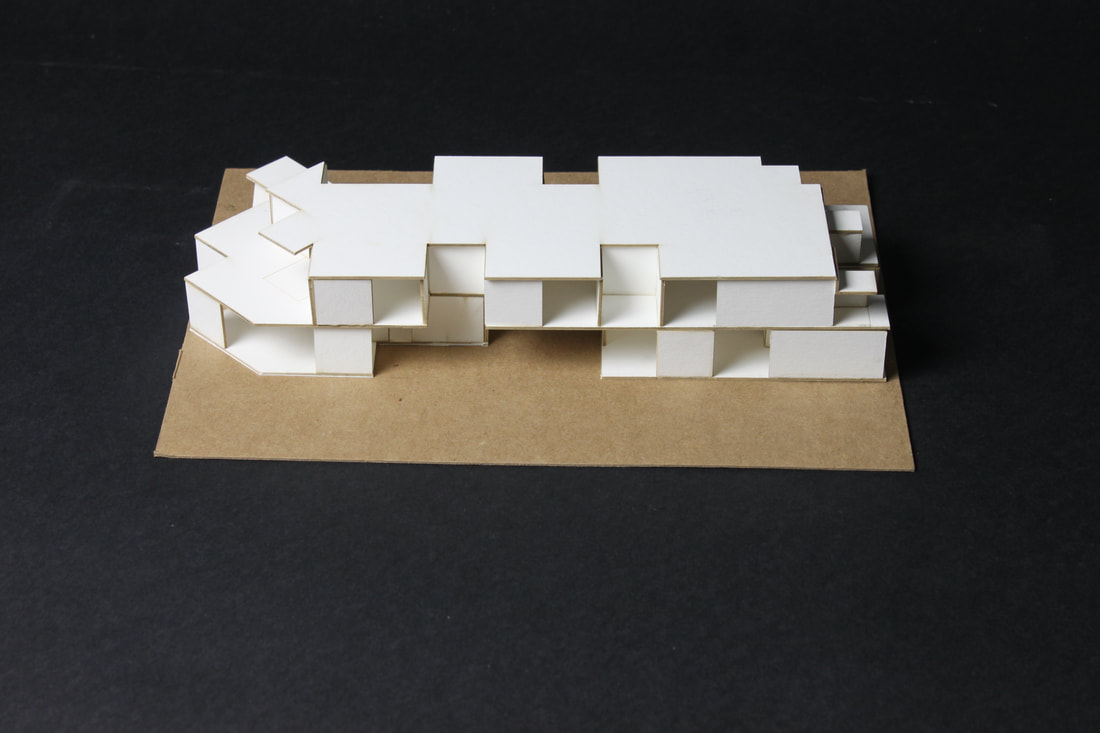
This concept is for the library. It is basically a group of cube rooms that seem random. In reality there are layers, only slightly escalating or descending. While the interior can be smooth, the exterior shows the guts, all these cubes, it looks like a geode. Additionally, there can be a creation of types of spaces depending on material. Three materials, defined by their permeability, create different spaces/experiences. There would be use of gate, which can connect upper levels to lower levels, and one room to another. There would also be some type of solid material, that can separate certain areas, or provide privacy. Finally, there can be "empty" walls, meaning they are left open for complete connection to another space.
|
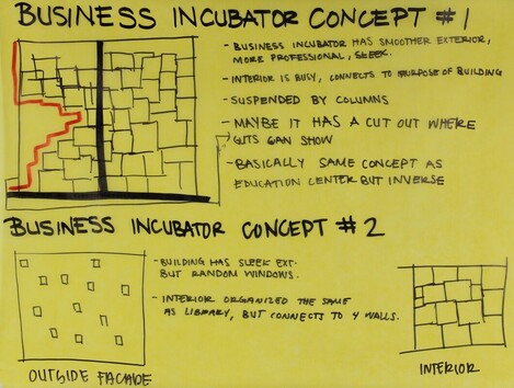
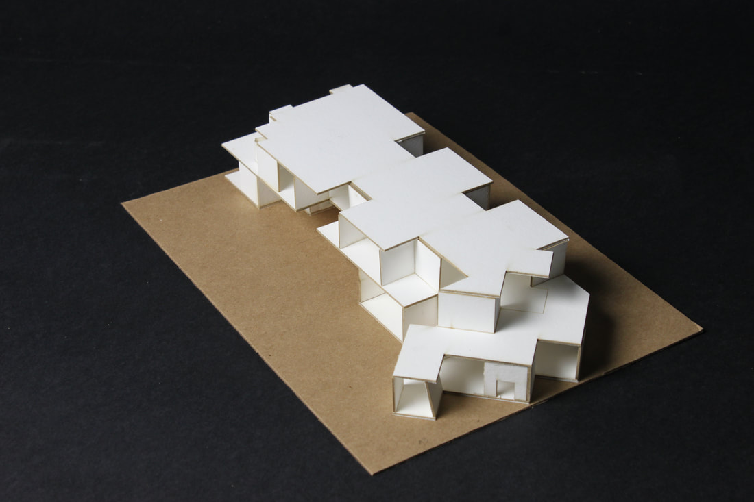
Business Incubator Concepts
For this building, I plan to have a business incubator. A business incubator is a place where small businesses can get started up/accelerated. For this concept, I wanted to basically flip the last concept on its head, instead of the rigid exterior, this exterior will be more smooth, professional. The inside, however, would have similar structure.
|
Schematic Design
|
|
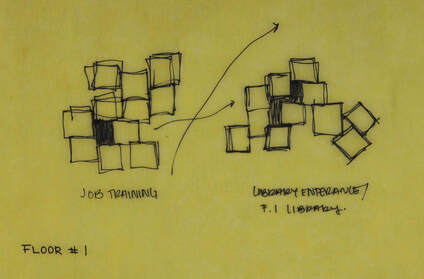
Some of the first floor plans I had drawn are where the idea for a pathway under the main library came from. In one of them, a plan for a park area behind the library is shown, which is something I would have wished to have gone more in depth on, but realized that the library was a project that required more attention than I had initially thought. These plans still show the connection between the two spaces on the first floor.
|
|
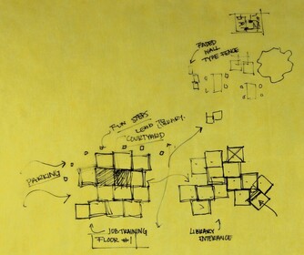
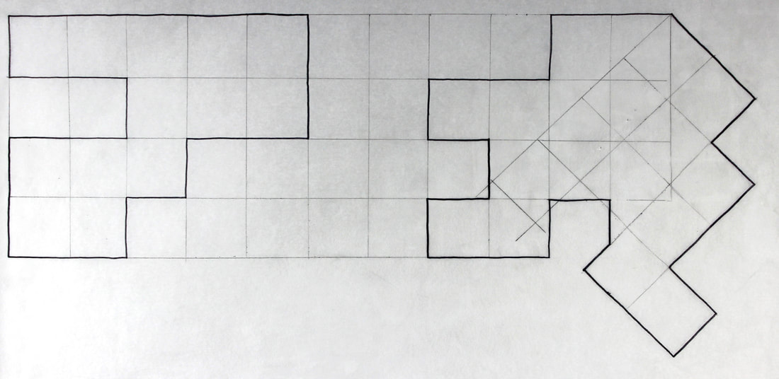
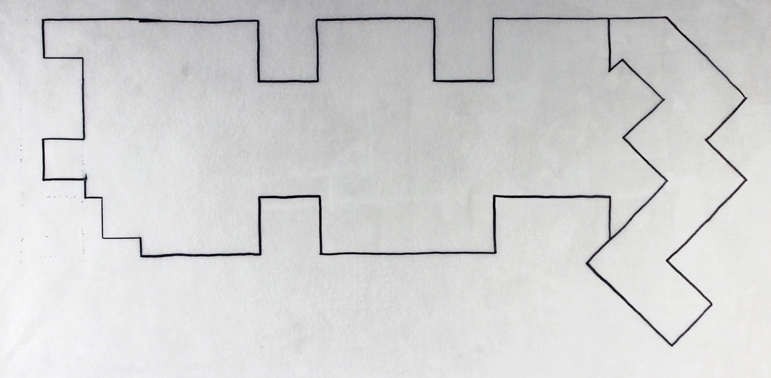
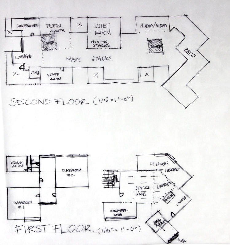
More developments were made in these plans. I began to plan out the usage of space. While the placement changed on most of the rooms, the stacks/main library floor remain in the same areas throughout the rest of the planning for the building.
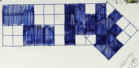
This sketch was done to "officially" lay out where these squares areas would be placed (some minor changes where made). I decided to rotate one end of the building to face Bexar St. , which opens up the façade to a viewer on Bexar. This helps to connect the viewer to the building more effectively than it would have if it was a simple block. It also flows of the layout of the neighborhood nicely.
|
|
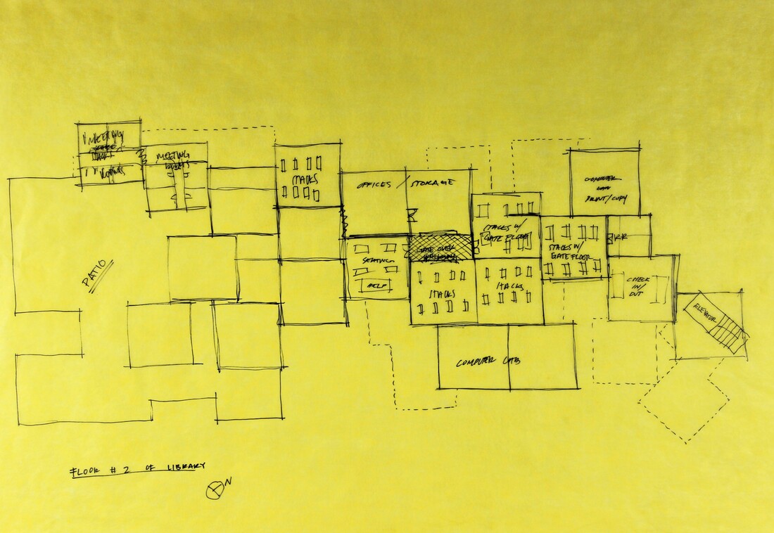
Floor one and two are shown here. This is the final design I went with, just in a clearer format.
|
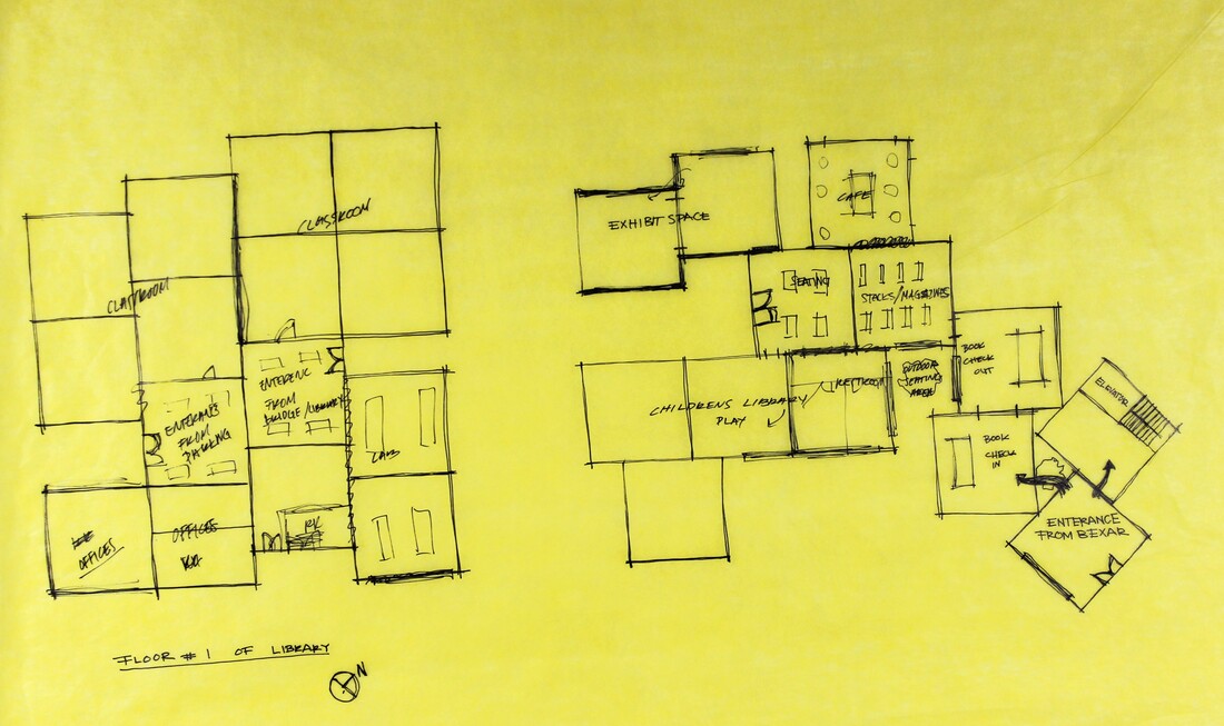
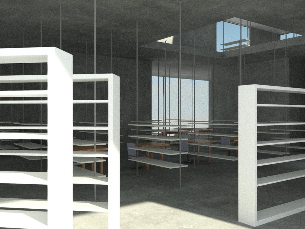
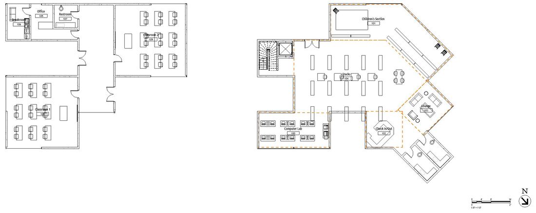
These floor plans are what I used to lead me in Revit. The layout is finalized here. I placed the children's library on the intersection of where the building turns 45 degrees. This is to connect the children with the park. The main room will house stacks and magazines, and a computer lab, lounge, and the bathrooms are located in the front of the building. The classrooms are connected by a hallway, and the bathrooms/breakrooms are located in the back.
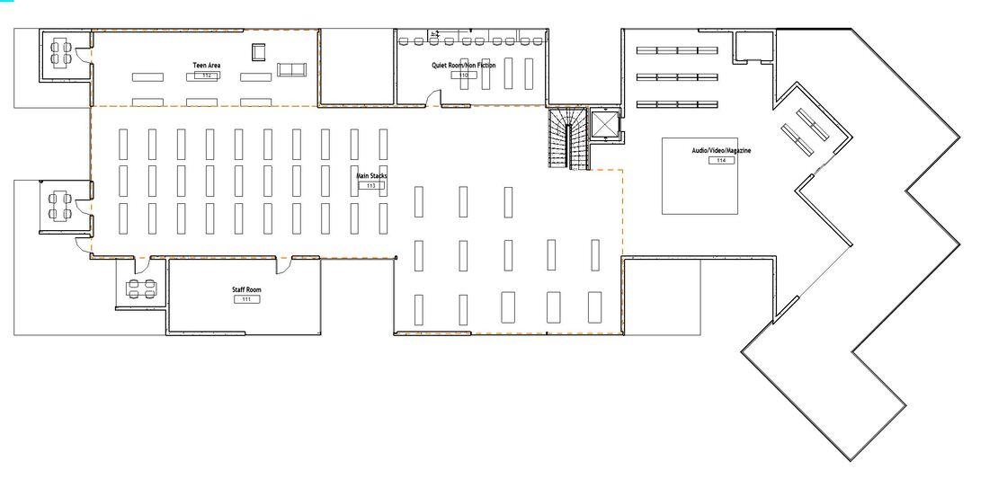
On the second floor, It is where the main stacks are located, The teen area (where teen books/lounge are) is located facing west, and there is also a secluded quiet room, and audio/visual room. There is also a staff room and several studies (private rooms) scattered across the floor. The patio faces Bexar to promote he connection even further. |
|

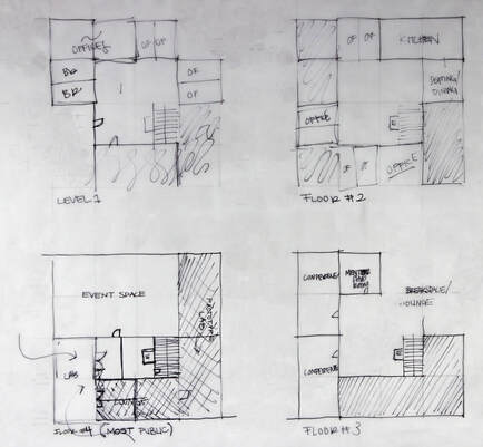
This is the layout for a business incubator, it is a cube with some sections taken out of it. The more public spaces are located towards the floor, and the private areas are up higher (more isolated).
|
Final Design
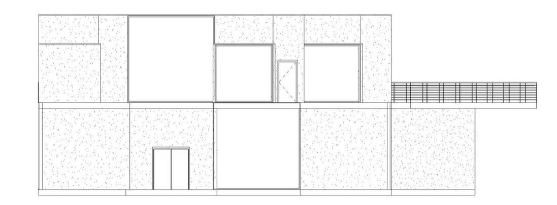
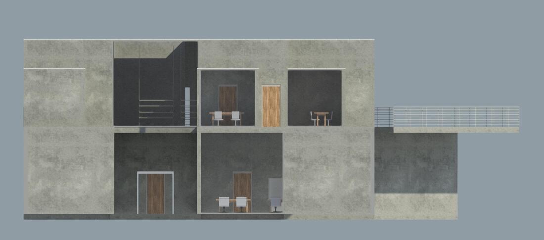
Elevations
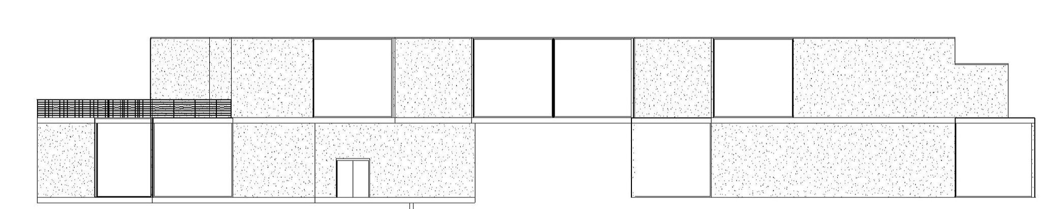
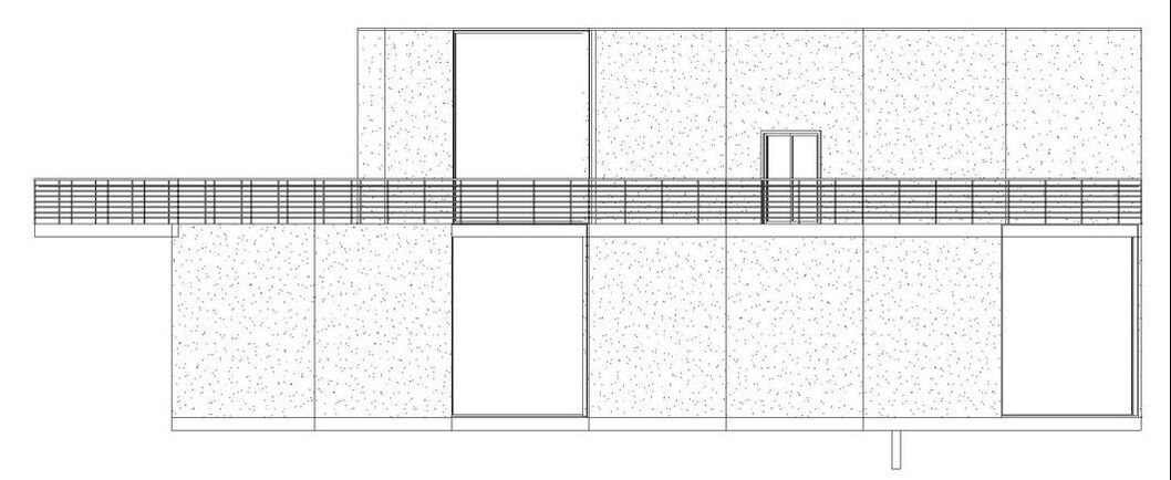
North Elevation
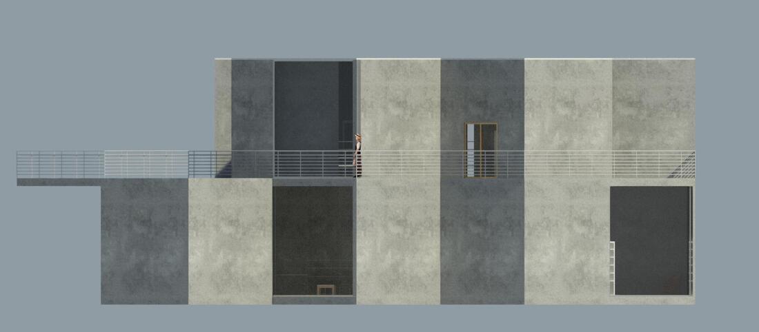
East Elevation
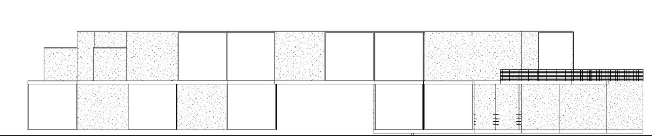
South Elevation
West Elevation
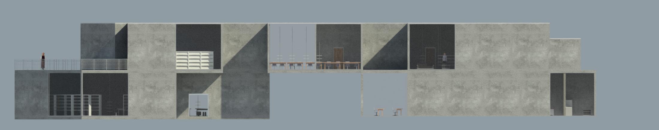
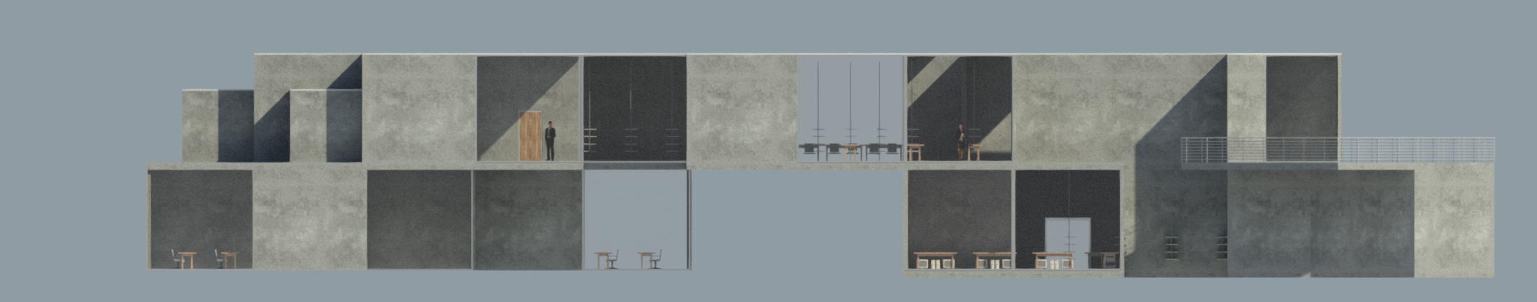
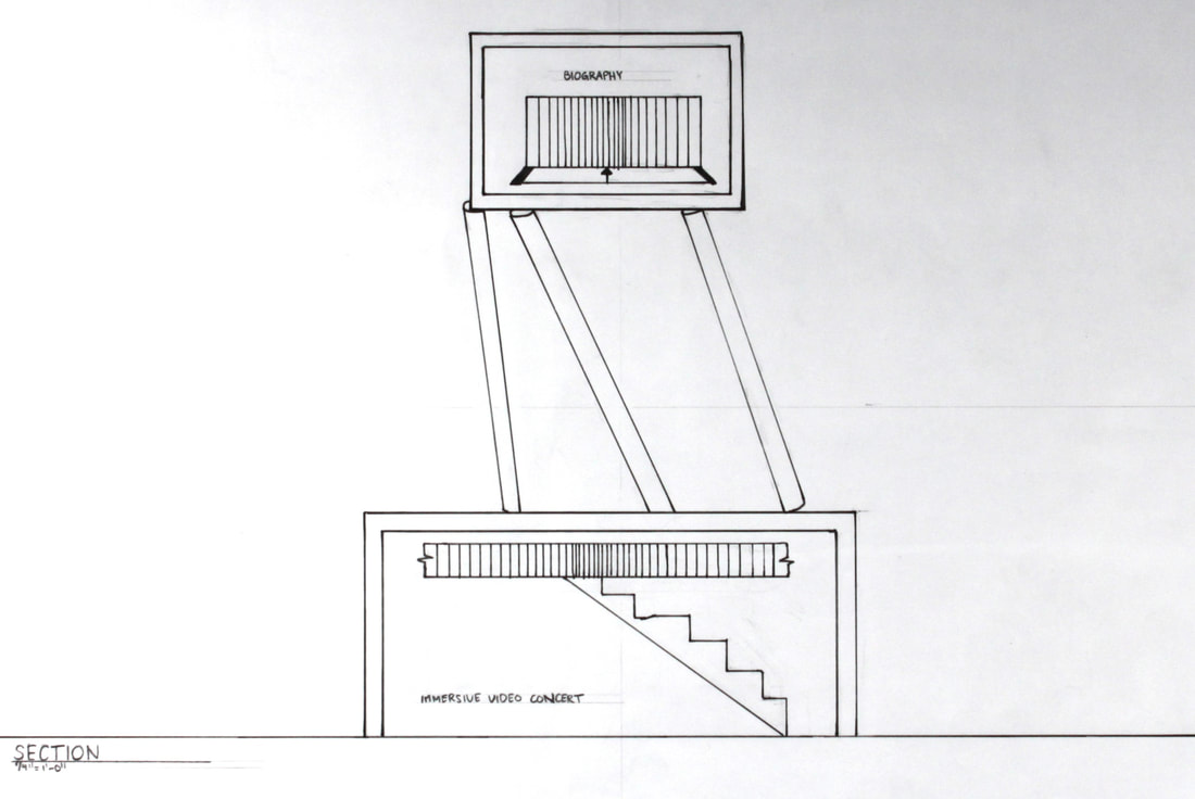
Sections
Rendering
Plans
Models
|
|