Sustainable Architecture
One of the most complicated and problematic issues that people face in this 21st century era is dealing how to construct settlements in harmony with nature, always taking into account a creative dialogue, rather than a Utopist selection.
Sustainable Architecture: To be more ecological when it comes to the architectural field. In other words, its main purpose would be to construct a building or even an urban design that are self-sustainable which would positively or neutrally affect the environment rather than harming the beautiful nature. Additionally, the philosophy of sustainable development applied to architecture would focus on the design and construction of environment-friendly buildings.
Sustainable architecture is a pretty broad term, which basically seeks to minimize the negative environmental impact of buildings through conscious design, energy efficiency, choice of materials, development space and the ecosystem at large.
Project 01 - Sustainable Architecture: Transforming Landfill into Park
Main part of the project was to select a certain area in North Texas, an area near where I live, and think of ways to be more architecturally sustainable.
At first I had no idea where to start with, however when I was driving by the Carrollton area where I realized a pungent smell coming from the landfills. That's when I came up with the idea to mainly focus my project on transforming a landfill into a park.
At first I had no idea where to start with, however when I was driving by the Carrollton area where I realized a pungent smell coming from the landfills. That's when I came up with the idea to mainly focus my project on transforming a landfill into a park.
Background Research
Just in this Carrollton area, there were three different landfills that were located within. Therefore, I felt that it would be unnecessary to utilize three different landfill locations which allowed me to finalize my project on the DFW Landfill.
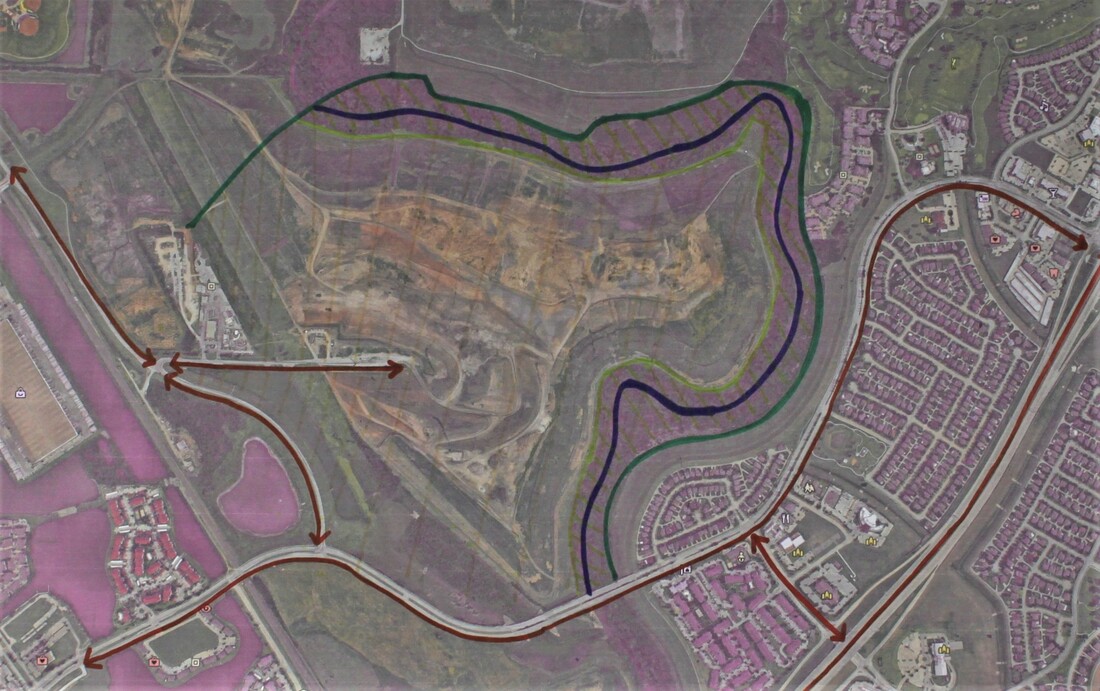
As you can see in the map this landfill is big in size, and it is located at an area where there are so many residence. I came to realize residents living near this area was having discomfort with the nasty smell that was coming from the trash mountain.
As you can see in the map this landfill is big in size, and it is located at an area where there are so many residence. I came to realize residents living near this area was having discomfort with the nasty smell that was coming from the trash mountain.
Measurements/Flows
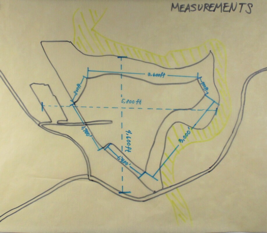
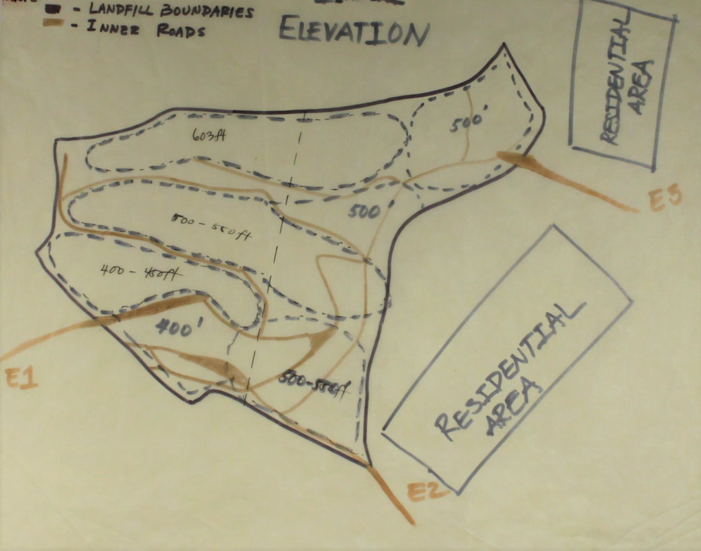
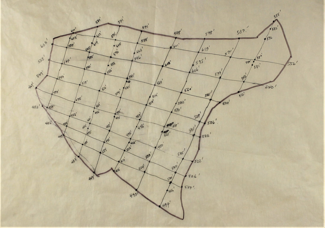
After selecting a specific site, I went further into finding the measurements starting with the overall width and length of the site which came out to be about 5,800ft long and 4,600ft wide, a very large space. I then utilized Google Earth to find out the site elevation how high and low different parts of the site is: all the way from 400ft to 600ft.
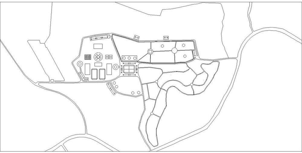
Working with a large space was troublesome, therefore research over the current flow of the landfill of where population go in and out and move around the site itself was very much needed. As I drew the flow map, I realized that there was only one entrance. This would be very inefficient which led to me to come up with a variety of different entrance ideas as well as parking distributions according to those entrances.
|
|
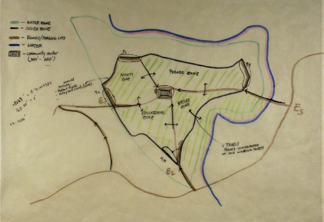
Entrance/Parking DistributionBecause this site was a ginormous space, it would be much more efficient if there was a certain central point where everything meets, so I based all my ideas on that one central point where I would be locating a community building that operates according to different parts of the areas.
|
|
After deciding on the entrance/parking idea, I went on to creating, once again, another flow map indicating the varying flow of the populations. I was able to determine how and where people will be accessing the areas. This has led me to making few adjustments realizing that there are some areas where it would require a lot of walking for the visitors which is definitely something not acceptable in Texas due to the weather.
|
Zone Distribution/Specific Development
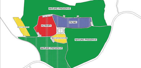
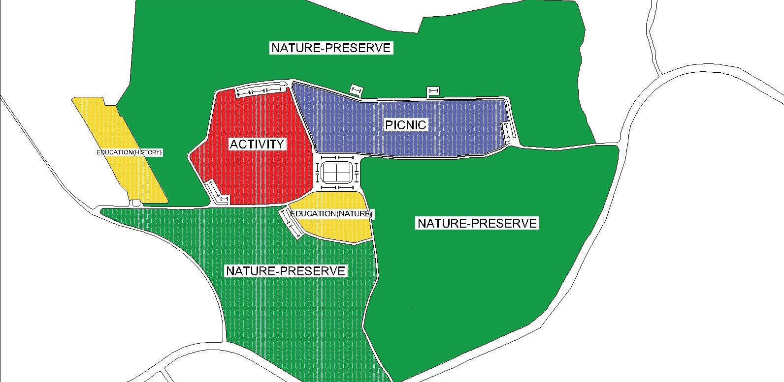
I've decided to divide the park into four different zones.
- For the first zone, it would be a picnic area where visitors can relax and have a typical picnic-time where they will be able to experience nature in some type of way.
- Second zone would be used for activities such as football fields, soccer fields, playgrounds, outdoor basketball courts, sand volleyball court as well as a community center.
- For the third zone, I would dedicate it for educational purposes as, in my opinion, educating people more about sustainability is one of if not the most important step into further capturing the support for sustainability. In those educational zone it would include educational activities such as edifying the young students over the nature-preserve: different living species, habitats, and more.
- Lastly, one of the zones will be used as a nature-preserve zone. In the Living Building Challenge, one must dedicate an equal amount of land used for the project to be preserved. In this zone, it would also include trails where visitors would be able to walk and be part of the nature itself.
After the development of these specific zones, I went on to developing each zones.
The Activity zone includes:
The Activity zone includes:
- Football/soccer fields
- Sand volleyball courts
- Outdoor Basketball Courts
- Parkour course
- Playground
- Gazebo for parents and bathrooms
- Dog care/park
- Central plaza that includes sustainable walk-in water fountain
- Barbecue cooking/eating spaces
- Gazebos for resting
- Empty spaces for visitors to have separate/individual activities
- Little gazebos dedicated for educational activities
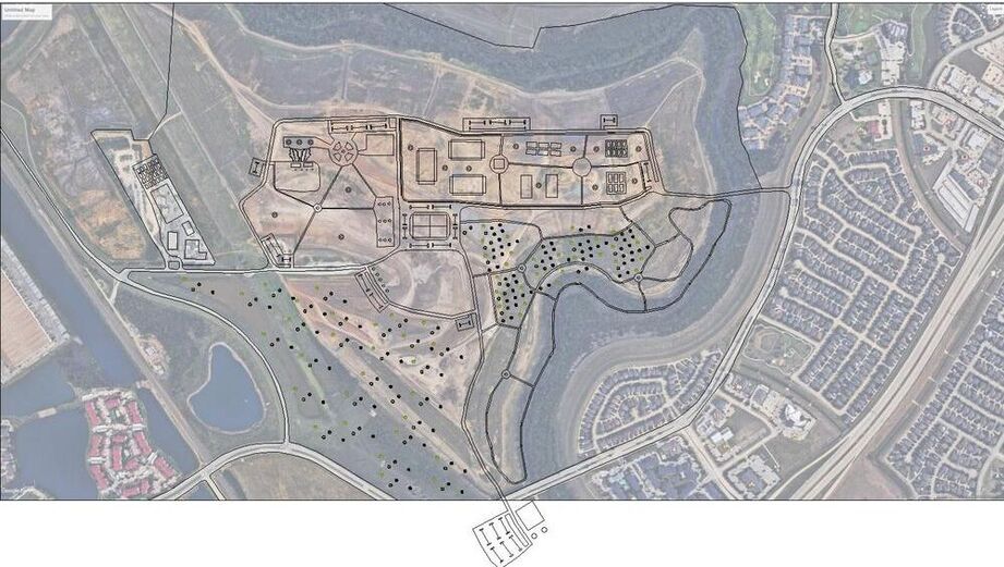
- Trails
- Central connection in some location of the trail.
Project 02 - Continuation of the Landscape Project
The second part of my project was mostly related to readjusting the park according to the landscape of the site as well as developing an additional gazebo that is located within the site.
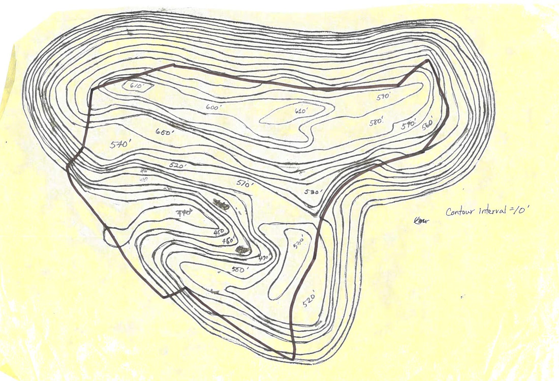
This should have been my first step for this entire project, but I did not realize it until the start of the second part of the project. The idea of re-evaluating the entire site, mostly focused on the elevation, was something that was needed to continue developing the project. Because there wasn't any topographical map provided online, I had to draw grids on the aerial view and determine the elevation for each of the intersecting points. I used those data to further create a topographical map with the contour interval of 10 feet.
|
After creating the contour lines/topographical map, I transferred the drawings onto AutoCAD to trace them and lazer cut them in order to create a study model. I had traced each contour lines and converted them up to scale, and finally lazer cut them. After getting each layers I went onto the shop to put them together into a model.
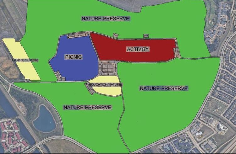
After creating the modes, I realized that the activity zone, which needs a lot of flat surfaces for sports activities, had a lot of varying elevations. On the other hand, in the picnic zone, the elevations were fairly stable and flat which had led me to completely switching the two zones. |
|
As seen in the picture, the previous site that I have developed had the activity zone(Red) on the left side, but on the right side of the picture, I have swapped the two zones, picnic and activity zones, according to the elevations that existed. This was an idea of adapting to the existing site to reduce further disruption and continue supporting this project as a sustainable project.
After this process, I had to remake the model, that indicates the fixed elevation in the new activity zone. I had to go through the same process once again, but this time I had added additional pieces to raise and completely flatten the elevation for the new zone.
Continuation: Gazebos
Texas is known as this hot desert. Its weather is so hot that I had to take in consideration when it came to suns and heat. Since it's a park, I had to come up with an idea where I can allow the visitors to be in a position where they could rest and get away from the sun after a long period of time.
|
|
Instead of creating an entire, separate closed building, I decided to utilize the idea of a gazebo. The main reason why I was attempting to avoid using a main building was because of its excessive use of energy which could be considered, "unsustainable". Instead, if I use the gazebo, it will utilize the natural shadowing through extended roofs. Additionally, I came up with the idea of rain water storage system after I went on a field trip in my class. The Kubota Company had a building where the roofs were adjusted and made to store the rainwater and utilize them in their irrigation system. I had utilized this idea.
|
|
I came up with 3 different concepts for my gazebo design. The first one shows an extended roof that is shaped in a "V" shape where eventually the rainwater would be storage and transferred down to the water filtration through natural gravity. Additionally, I included an extended roofing system that will provide shadow.
The second concept was a bit more like a traditional shaped gazebo which will still be able to store rainwater and utilize them. The third concept had the design that looked like a cave where there is only one entrance and closed back in order the rainwater to flow down along the roof down to the water filtration. It also included an extended roofing for the shadows as well. The overall concept of my park was both modern as well as traditional designs which led me to choosing the first concept of the gazebo. |
|
After the steps of coming up with varying concepts and choosing one, I went on to further developing in SketchUp. I had made the design in SketchUp. Although because of some limitation in SketchUp, I was not able to fully show the extended roof that would provide shadow for the visitors however, I still was able to portray my general idea of how the surrounding environment would look like near gazebos all across the park.
As seen in the SketchUp picture, the overall design allows rainwater storage system which I thought/considered very sustainable. Obviously, I would not really utilize the water from rainwater to use it as drinkable water, I would rather use it for bathwater, irrigation system for grasses and trees in the park. As seen in the picture, it is one of the parts in the Nature-Preserve Zone where people could walk around and hike. This gazebo would act in way to help hikers to take a break from the heat/sun for a little bit.
